Monitored Areas and Sub-areas
A monitored area is a polygon that a user draws or uploads. A monitored area can contain named sub-areas. See Get user monitored areas for the API documentation.
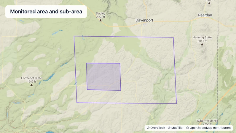
Colour
Monitored areas and sub-areas share the same purple #7957D5 outline and white #FFFFFF casing.
| Geometry | Main stroke | Casing | Fill |
|---|---|---|---|
| Monitored area | #7957D5, 1.5 px | White rgba(255, 255, 255, 0.5) at 50% alpha, 2.5 px | None |
| Sub-area | #7957D5, 1.5 px | White rgba(255, 255, 255, 0.5) at 50% alpha, 2.5 px | rgba(117, 89, 204, 0.2) |
Time series
The visible time window does not filter monitored areas or sub-areas.
Legend and labels
Use the area name to identify a monitored area or sub-area. WFS shows a sub-area's properties in a popup on click.
Zoom behaviour
Keep the monitored-area style as the map zoom changes. Show sub-areas from zoom 2 through zoom 17.
Interaction behaviour
Selecting a monitored area opens its monitor panel. Selecting a sub-area opens its properties popup.
Metadata
The monitor panel and sub-area popup present metadata used to identify and manage each area.
- Name — the name of the monitored area or sub-area, used to identify it.
- Area — the size of the monitored area, used to understand its coverage.
- Sub-area properties — the properties supplied for a sub-area, used to provide its additional context.