Fire Clusters
A fire cluster groups hotspots that are close in space and time. Its shape is derived from those detections. See Clusters for API use. Retrieve the current type and cause values from the cluster types and cluster causes endpoints.
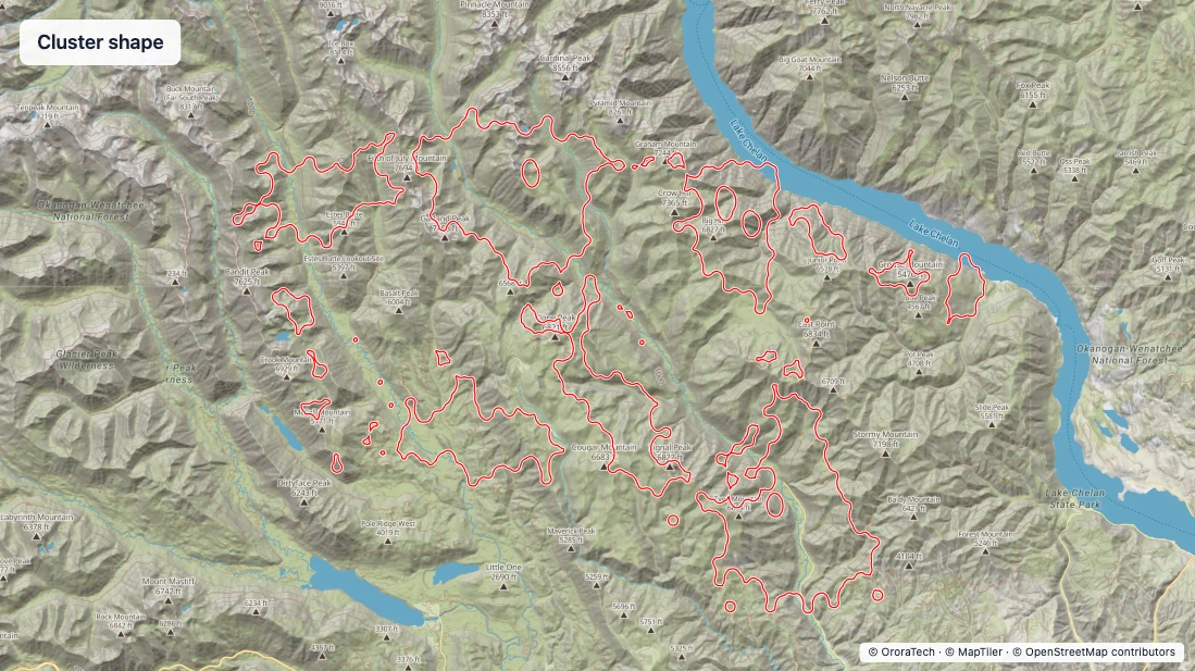
Cluster shapes and icons
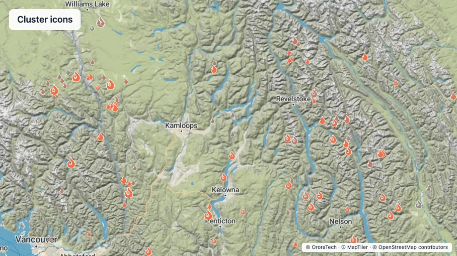
WFS presents a fire cluster as a shape or a centroid icon.
| View | Representation |
|---|---|
| Shape | The derived cluster geometry. |
| Icon | The cluster's classification icon at its centroid. |
Cluster shapes have two modes.
| Shape mode | Geometry |
|---|---|
| Worst Case | A broader shape that includes the full error margin. |
| Optimized | A smaller, more precise shape. |
Colour
Cluster colour distinguishes fire and unclassified clusters from static and non-fire clusters.
| Content | Main stroke | Casing |
|---|---|---|
| Fire or unclassified cluster | #FF0000, 1.25 px | #FFFFFF, 3 px |
| Non-fire cluster | #000000, 1.5 px | #FFFFFF, 3 px |
Use a solid main stroke for low earth orbit (LEO) clusters and for clusters that contain
LEO and GEO detections. Use a 4 px dash and an 8 px gap for clusters containing only
geostationary orbit (GEO) detections.
Use the hotspot recency ramp for fire and unclassified markers. Use dark grey
rgb(54, 54, 54) for non-fire markers.
Time series
The visible time window determines which clusters are shown and normalises the recency colour of their centroid markers.
Legend and labels
Use the classification icon for each centroid marker. Identify the dashed GEO-only style and marker-size scaling in the cluster legend.
Scale fire and unclassified centroid markers by hotspot count.
| Hotspot count | Scale |
|---|---|
| 100 or fewer | 1.0 |
| 101–5000 | 1.4 |
| More than 5000 | 1.8 |
Classification icons
Classification icons identify the type assigned to a cluster.
Fire and unclassified types use the red #FF0000 active-fire outline. Non-fire types use the black #000000
static or non-fire outline.
| Classification | Icon | Unclassified, fire, or non-fire |
|---|---|---|
| Unclassified | ot-fire | Unclassified |
| Fire | fire-flame-curved | Fire |
| Forest | trees | Fire |
| Cropland | wheat | Fire |
| Grassland | seedling | Fire |
| Structure | house | Fire |
| Peat | shovel | Fire |
| Not a Fire | xmark | Non-fire |
| Industry | industry | Non-fire |
| Factory | industry | Non-fire |
| Steel | hammer | Non-fire |
| Cement | trowel | Non-fire |
| Oil or Gas Flare | fire-flame-simple | Non-fire |
| Volcano | volcano | Non-fire |
| Solar Panels | solar-panel | Non-fire |
| Sun Glint | sun | Non-fire |
| Processing Error | robot | Non-fire |
| Harvested Field | sickle | Non-fire |
| Forest Clearing | axe | Non-fire |
| Hot Stone | stones | Non-fire |
Zoom behaviour
Below zoom 8, show one marker at the cluster centroid. At zoom 8 and above, show the cluster shape.
Interaction behaviour
Use a 3 px cyan #04CECF outline with no fill for a selected cluster shape. Use cyan #04CECF instead of the
normal colour for a selected centroid marker.
Selecting a centroid centres the map and moves to zoom 10. Selecting a cluster shape does not change the zoom.
Metadata
The following metadata is useful for users when viewing fire clusters. We also recommend providing a link to the respective cluster in the WFS platform.
- Cluster ID — the unique cluster reference, used to match the cluster with API data.
- Location — the geographic position of the cluster, used to place the fire.
- Classification and cause — the current fire assessment and its cause, used to understand what the cluster represents.
- Detection times and lifetime — the first detection, latest detection, and elapsed lifetime, used to understand recency and duration.
- Hotspot count — the number of detections in the cluster, used to understand how much detection data it contains.
- Incident name and status — the related incident and its current status, shown where available to provide operational context.
- Fire confidence — the confidence that the cluster represents a fire, shown where available to support assessment.
- Affected area and fireline intensity — measures of fire extent and intensity.