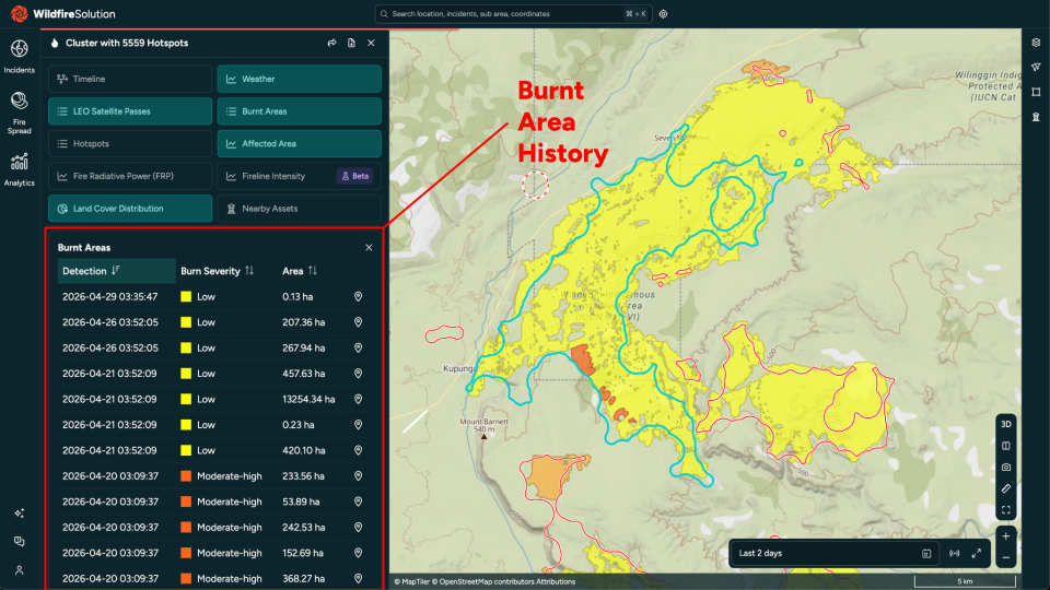
Burnt Areas
A burnt area represents the charred perimeter of land affected by a fire, derived from satellite imagery. It is characterised by:
- a unique identifier
- a polygon geometry describing the burnt perimeter
- a centroid point
- pre- and post-event acquisition timestamps
- spectral metrics (dNBR, dNDVI)
- a confidence score
- the area in m²
Burnt areas are computed by analysing pairs of pre- and post-fire satellite products. Unlike hotspots, which represent individual thermal detections, a burnt area describes the spatial extent of damage after a fire has occurred.
Search
The main endpoint to retrieve burnt areas is:
The endpoint searches for burnt areas whose centroid falls within a passed bounding box, filtered by a time range and other optional parameters.
If you already have a cluster of interest, you can retrieve all associated burnt areas directly via GET /v1/clusters/:id/burnt_areas/ without needing to specify a bounding box.
Parameters
Bounding box
The area of interest is defined by:
xmin, the minimum longitudeymin, the minimum latitudexmax, the maximum longitudeymax, the maximum latitude
The bounding box filter is applied to the centroid of the burnt area, not to its full perimeter. A burnt area whose centroid lies outside the bounding box will not be returned, even if part of its perimeter overlaps with it.
Date range
Time filters are passed as date and minutes parameters, where:
dateis the end of the time range (defaults to now if omitted)minutesis the range before the end date, expressed in minutes
For example date=2024-01-15T00:00:00Z and minutes=2880 translates to:
Jan 14th 2024 00:00 UTC - Jan 15th 2024 00:00 UTC
The following date formats are supported:
- ISO 8601 (e.g.
YYYY-MM-DDTHH:mm:ssZ) YYYY-MM-DD-HHmm, whereHHmmis the time expressed in UTC
The time range is applied to post_time, which is the acquisition time of the post-event satellite image used to detect the burnt area.
EPSG
The supported EPSG codes are:
The epsg parameter defines the coordinate reference system of both the bounding box coordinates and the feature geometries returned in the response. The default is 4326.
The bounding box coordinates are interpreted according to the specified EPSG code. If the bounding box is passed in a different CRS, the results may be incorrect.
Select
The select parameter allows to include additional information in the response. The supported values are:
shape: includes the full burnt area polygon geometry instead of the centroid pointclusters: includes the fire clusters associated with this burnt areapre_product: includes metadata about the pre-event satellite productpost_product: includes metadata about the post-event satellite productimage_sets: includes the COGeo image sets for both pre- and post-event products (impliespre_productandpost_product)window: includes the analysis window geometry used to detect the burnt area
Multiple values can be passed as a comma-separated list.
By default, the geometry of each returned feature is the centroid (Point). Pass select=shape to receive the full polygon.
Area Unit
The unit_area parameter controls the unit used for the area property in the response. The supported values are:
sqm— square metres (default)sqkm— square kilometresha— hectaresac— acres
Localization
If localization=true is passed, timestamps and area values are automatically converted based on the user's locale settings.
Response
The server responds with a GeoJSON FeatureCollection. Each feature represents a single burnt area.
If no burnt areas were found for the specified parameters, the response will be an empty FeatureCollection.
The following properties are always included for every returned feature:
| Property | Description |
|---|---|
id | Unique identifier of the burnt area |
area | Area in the requested unit (default: m²) |
pre_time | Acquisition time of the pre-event satellite image |
post_time | Acquisition time of the post-event satellite image |
mean_dnbr | Mean delta Normalised Burn Ratio within the perimeter |
mean_dndvi | Mean delta NDVI within the perimeter |
confidence | Algorithmic confidence score between 0.0 and 1.0 |
severity | Burn severity class (unburned, low, moderate_low, moderate_high, high, unknown) |
Single Burnt Area
To retrieve the full details of a specific burnt area by ID:
This endpoint does not require a bounding box. It accepts:
select— same values as the search endpoint (shape,clusters,pre_product,post_product,image_sets,window)unit_area— same area unit options (sqm,sqkm,ha,ac)localization— same localization flag
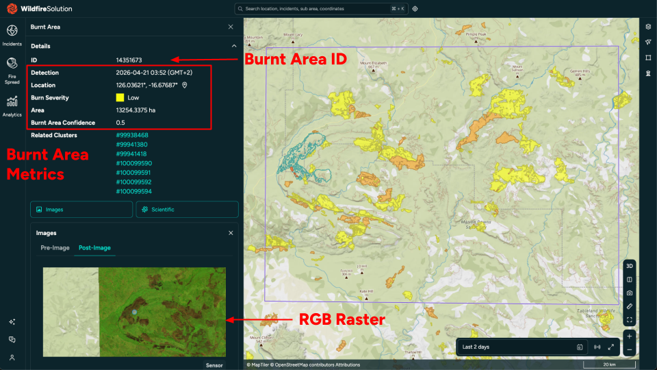
The response is a single GeoJSON Feature (not a FeatureCollection) with the same properties as described in the Response section above.
Search by Cluster Context
Burnt areas for clusters in a bounding box
This endpoint searches for clusters within the given bounding box and time range, and returns all burnt areas that are associated with those clusters. It accepts the same bounding box, date range, EPSG, select, unit_area and localization parameters as the main search endpoint, plus the following cluster filters:
Cluster filters
| Parameter | Description |
|---|---|
confidence | Minimum cluster confidence (0.0–1.0) |
min_fire_confidence | Minimum fire confidence level (low, medium, high, very_high) |
max_fire_confidence | Maximum fire confidence level (low, medium, high, very_high) |
include_no_fire_confidence | Include clusters with unknown fire confidence (default: true) |
num_fires | Only consider clusters with at least N hotspot detections (default: 1) |
type | Filter clusters by classification type. Refer to GET /v1/clusters/types/ for the list of valid values. |
cause | Filter clusters by cause. Refer to GET /v1/clusters/causes/ for the list of valid values. |
satellites | Comma-separated list of satellite names. Only clusters that include at least one detection from the listed satellites are considered. |
algorithms | Comma-separated list of algorithm names. Only clusters that include at least one detection from the listed algorithms are considered. |
product_types | Filter on burnt area product type: high_resolution or low_latency. |
The time range and bounding box apply to the cluster, not the burnt area itself. A burnt area outside the bounding box or time window may still be returned if its associated cluster is within the search area.
Burnt areas for a specific cluster
Returns all burnt areas linked to a single cluster identified by its :id. This endpoint does not require a bounding box or time filter — all burnt areas associated with that cluster are returned.
Accepted parameters:
select—shape,clusters,pre_product,post_product,image_setsunit_area— area unit (sqm,sqkm,ha,ac)localization— localization flag
Because this endpoint is scoped to a specific cluster, no date range parameters are required.
Burnt area history for a specific cluster
Returns the burnt area shapes grouped per satellite overpass for a given cluster. Each feature in the response corresponds to a single product processing step (one satellite pass), with the union of all burnt areas detected during that pass.
This endpoint accepts no additional query parameters.
The response is a GeoJSON FeatureCollection where each feature has the following properties:
| Property | Description |
|---|---|
acquisition_time | Sensing start time of the satellite pass |
processed_at | Timestamp when the product was processed |
area | Total burnt area for this overpass in m² |
Features are sorted chronologically by acquisition_time.
This endpoint is useful for tracking how a fire's burnt perimeter grew over time, as captured by successive satellite passes.
Examples
Latest burnt areas
Retrieve burnt areas detected in the last 48 hours for a region in northern Australia:
curl -X GET \
    --url 'https://app.ororatech.com/v1/burnt_areas/?xmin=125.88825&ymin=-17.15467&xmax=127.15381&ymax=-16.30349&date=2026-04-30T16:21:00Z&minutes=2880' \
    --header 'apikey: <my-api-key>'
{
  "type": "FeatureCollection",
  "features": [
    {
      "type": "Feature",
      "geometry": {
        "type": "Point",
        "coordinates": [126.4821, -16.7354]
      },
      "properties": {
        "id": 10094827,
        "area": 3847200.0,
        "pre_time": "2026-04-19T01:48:00Z",
        "post_time": "2026-04-21T01:52:00Z",
        "mean_dnbr": 0.38,
        "mean_dndvi": -0.29,
        "confidence": 0.91,
        "severity": "high"
      }
    }
  ]
}
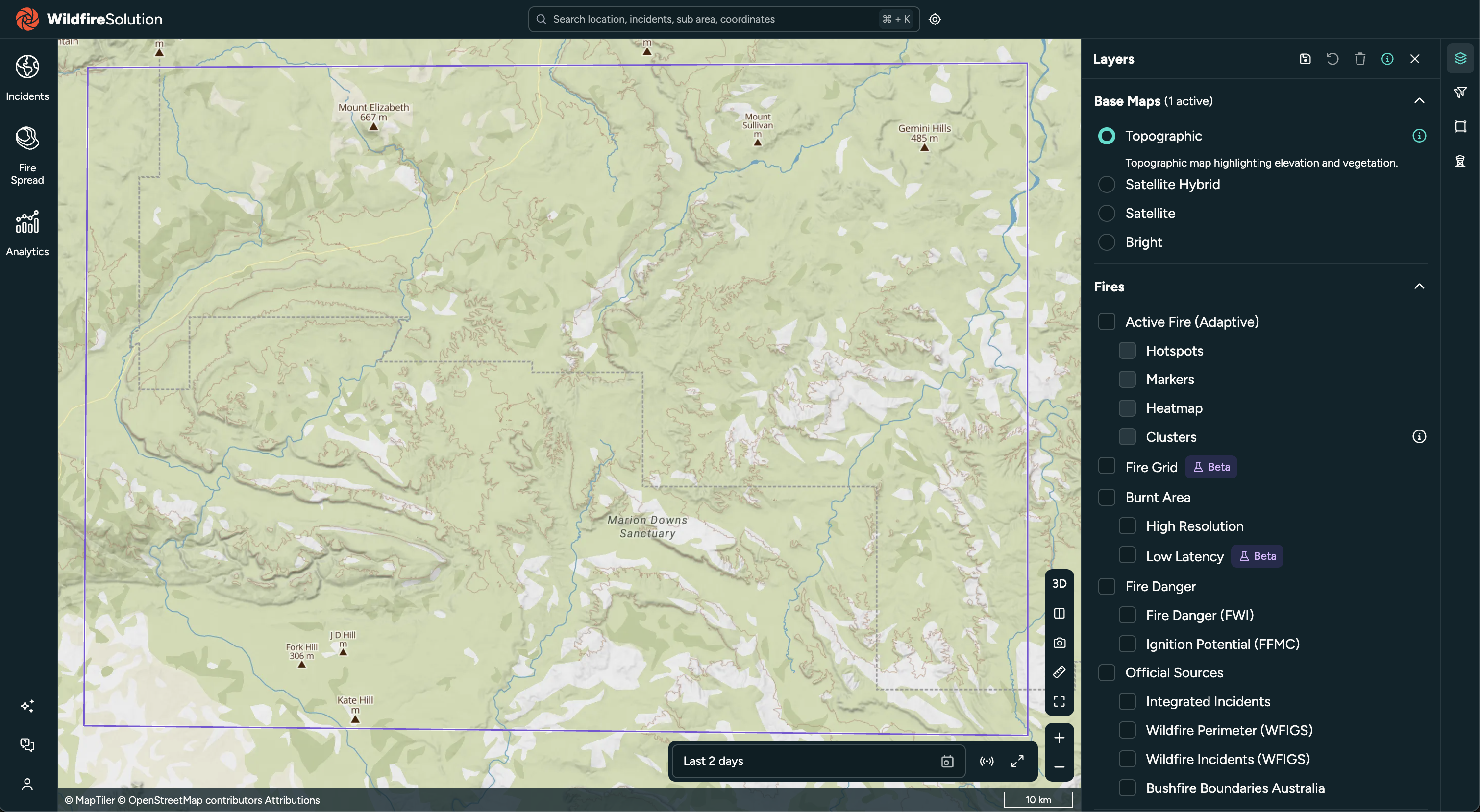
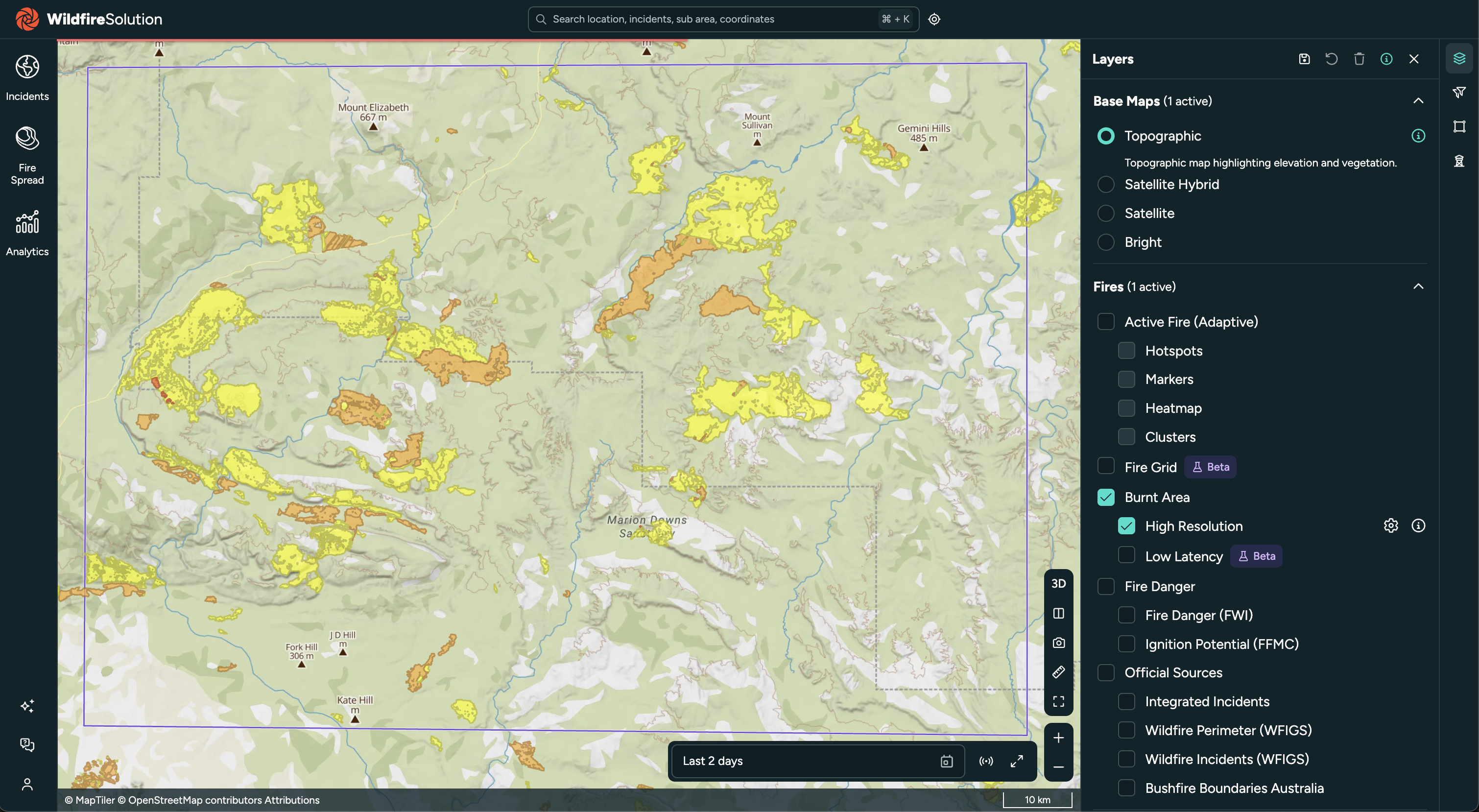
The bounding box drawn over the region of interest:
After the query is run, detected burnt areas are shown within the bounding box:
With full polygon shape
Pass select=shape to receive the burnt perimeter polygon instead of the centroid:
curl -X GET \
    --url 'https://app.ororatech.com/v1/burnt_areas/?xmin=125.88825&ymin=-17.15467&xmax=127.15381&ymax=-16.30349&date=2026-04-30T16:21:00Z&minutes=2880&select=shape' \
    --header 'apikey: <my-api-key>'
The geometry in each feature will be a Polygon or MultiPolygon rather than a Point.
Historical data
Retrieve burnt areas detected during a specific past period:
curl -X GET \
    --url 'https://app.ororatech.com/v1/burnt_areas/?xmin=125.88825&ymin=-17.15467&xmax=127.15381&ymax=-16.30349&date=2026-04-30T16:21:00Z&minutes=21069' \
    --header 'apikey: <my-api-key>'
The above request covers the full period from 16 April 2026 03:12 (GMT+2) to 30 April 2026 18:21 (GMT+2) — approximately 14.6 days (21 069 minutes).
Single burnt area with product metadata
curl -X GET \
    --url 'https://app.ororatech.com/v1/burnt_areas/10094827?select=shape,pre_product,post_product' \
    --header 'apikey: <my-api-key>'
Burnt areas for clusters in a region
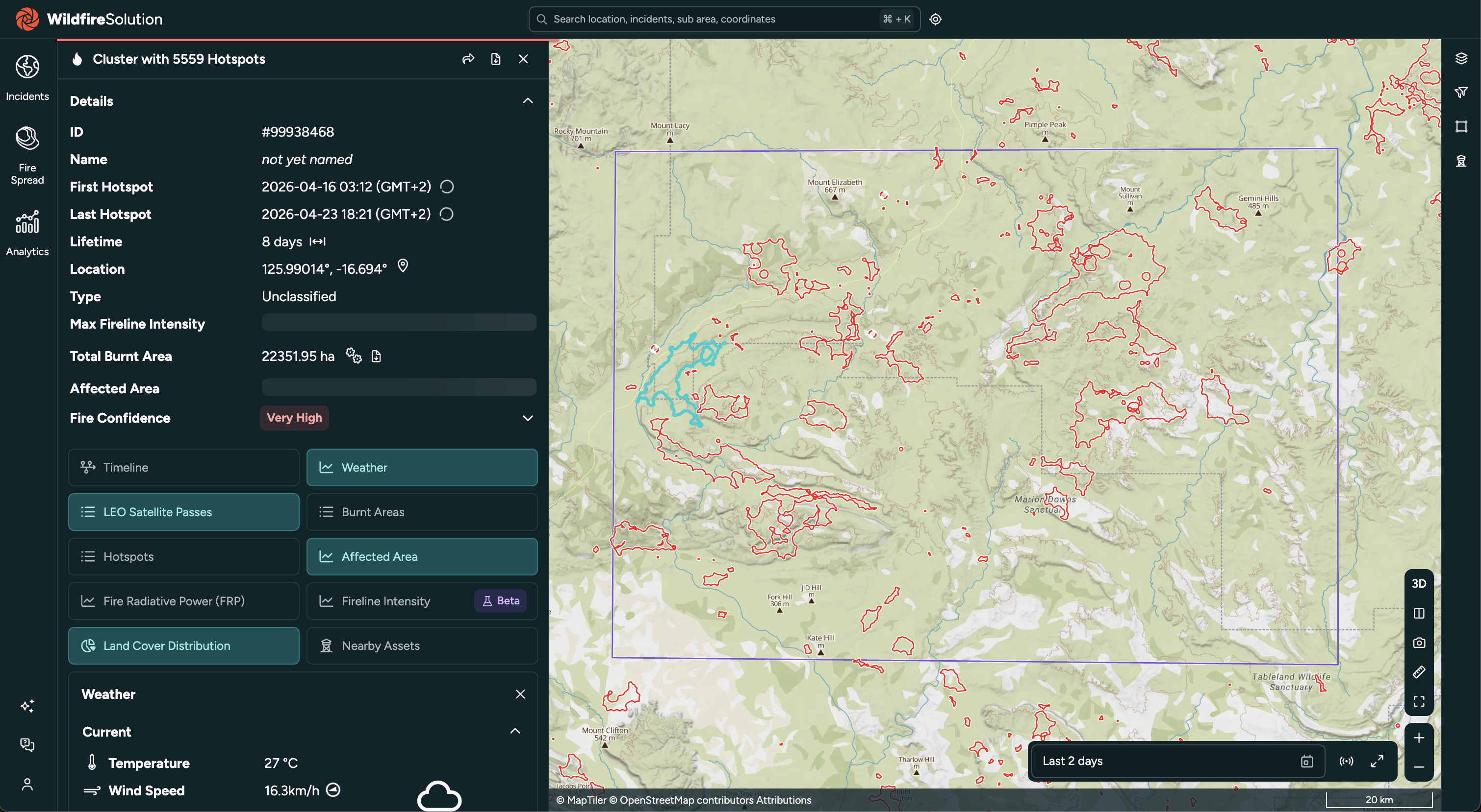
Retrieve burnt areas associated with fire clusters detected during the target period, filtering for high-resolution products and a minimum of 3 hotspot detections:
curl -X GET \
    --url 'https://app.ororatech.com/v1/clusters/burnt_areas/?xmin=125.88825&ymin=-17.15467&xmax=127.15381&ymax=-16.30349&date=2026-04-30T16:21:00Z&minutes=21069&product_types=high_resolution&num_fires=3&select=shape' \
    --header 'apikey: <my-api-key>'
Burnt areas for a specific cluster
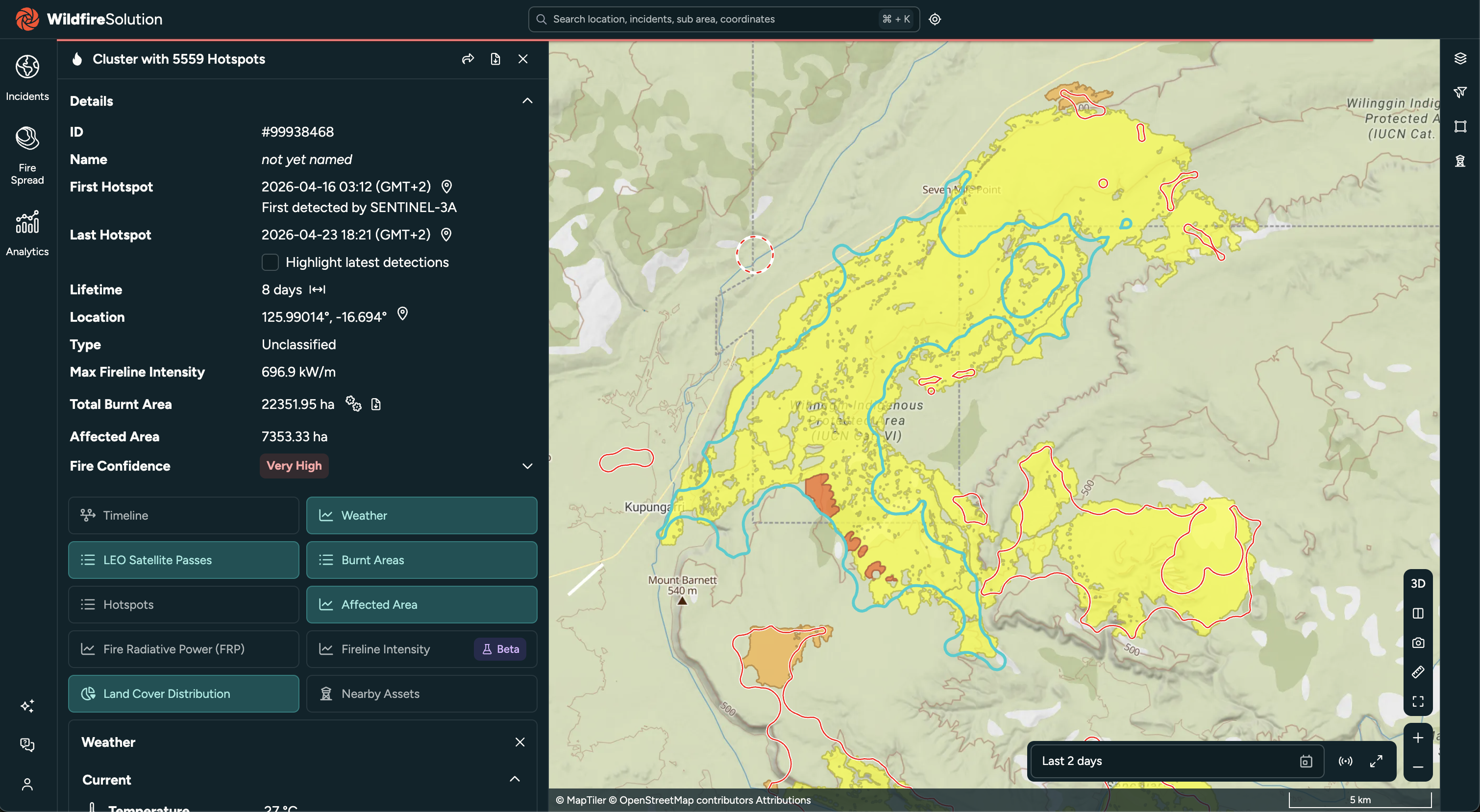
Retrieve all burnt areas linked to cluster 99938468:
curl -X GET \
    --url 'https://app.ororatech.com/v1/clusters/99938468/burnt_areas/?select=shape' \
    --header 'apikey: <my-api-key>'
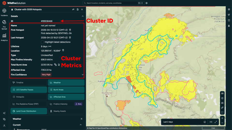
Selecting the cluster also opens its information panel:
Burnt area history for a cluster
Retrieve the perimeter growth over time for cluster 99938468:
curl -X GET \
    --url 'https://app.ororatech.com/v1/clusters/99938468/burnt_areas/history/' \
    --header 'apikey: <my-api-key>'
{
  "type": "FeatureCollection",
  "features": [
    {
      "type": "Feature",
      "geometry": { "type": "Polygon", "coordinates": [[...]] },
      "properties": {
        "acquisition_time": "2026-04-19T01:48:00Z",
        "processed_at": "2026-04-19T02:31:00Z",
        "area": 1240500.0
      }
    },
    {
      "type": "Feature",
      "geometry": { "type": "Polygon", "coordinates": [[...]] },
      "properties": {
        "acquisition_time": "2026-04-21T01:52:00Z",
        "processed_at": "2026-04-21T02:38:00Z",
        "area": 3847200.0
      }
    }
  ]
}
This can be extensive due to the number of burnt area polygons associated with a given cluster and their geometric complexity. For example, cluster 99938468 returned 47 burnt area polygons: