Burnt Areas
A burnt area shows measured vegetation change after a fire. It is not the current fire front. See Burnt Areas for the API, product types, severity values, and history.
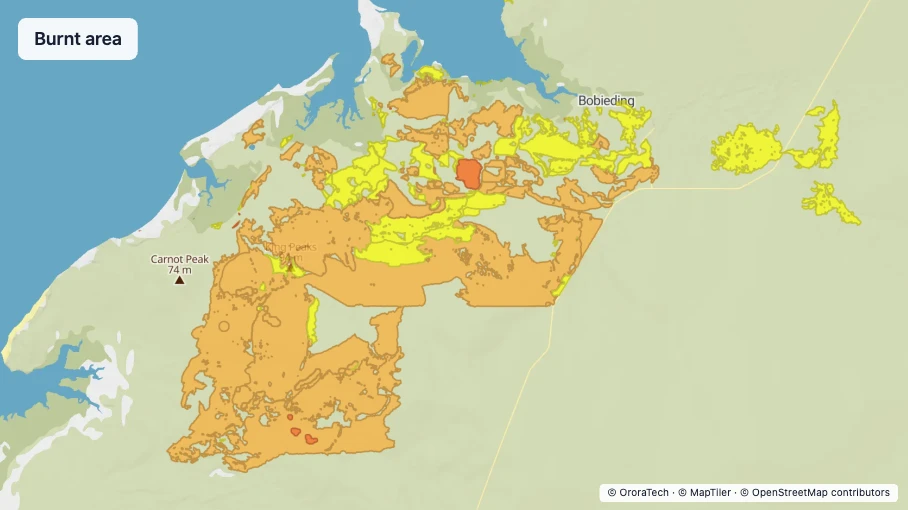
Colour
Use 75% layer opacity.
| Severity | Fill | Outline |
|---|---|---|
| Low | #F8FC0E | #BBBB0A, 1.5 px |
| Moderate-low | #F7B140 | #B8781D, 1.5 px |
| Moderate-high | #F8671A | #BA3D08, 1.5 px |
| High | #A601D3 | #70008E, 1.5 px |
The uniform-colour option uses fill #870505 and outline
#500303 at 1.25 px.
Time series
The visible time window determines which burnt areas are shown.
Legend and labels
Show every severity class in the legend.
Zoom behaviour
Keep the same burnt-area polygon representation as the map zoom changes.
Interaction behaviour
Retain the product fill and use a 3 px cyan #04CECF outline for a selected burnt area. Selecting a burnt area opens a detail panel.
Metadata
The following metadata is useful for users when viewing burnt areas.
- ID — the unique burnt-area reference, used to match the feature with API data.
- Detection time — when the burnt area was detected, used to understand the age of the measurement.
- Location — the geographic position of the burnt area, used to place it on the map.
- Burn severity — the measured severity class, used to interpret vegetation change.
- Area — the size of the measured polygon, used to understand its extent.
- Confidence — the confidence assigned to the measurement, used to support assessment.
- Associated cluster IDs — the clusters linked to the burnt area, used to connect it to detected fire activity. See Search by cluster context.